


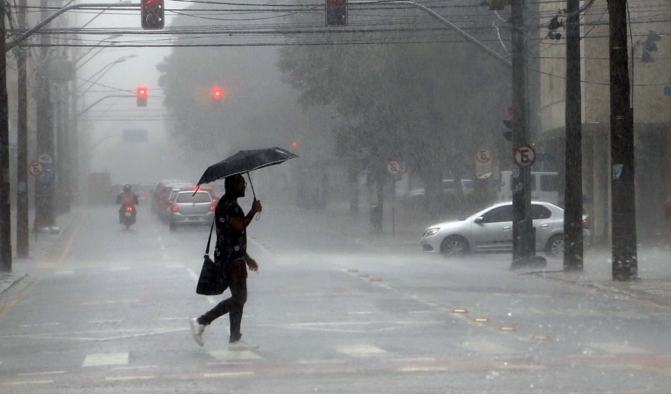
Heavy rain and thunderstorms are expected across the Brazilian state of Paraná on the first day of the year, meteorologists warned, with the potential for intense downpours, frequent lightning and gusty winds. Authorities and residents were advised to monitor forecasts and take precautions against localised flooding and storm damage.
Paraná storm forecast and what to expect
Simepar meteorologist Julia Munhoz told reporters that a combination of high atmospheric moisture, daytime heating and the passage of a trough through several atmospheric levels will encourage the frequent formation of strong, localised storms throughout the day.
“The first Thursday of 2026 will be marked by persistent rain over Paraná,” Munhoz said. “Storms are expected to produce large volumes of rain in a short interval, as well as a high incidence of lightning and the possibility of strong wind gusts. There is a tendency for these instabilities to weaken gradually by the end of the day.”

The greatest threats are intense short-duration rainfall capable of causing flash flooding, frequent electrical activity and isolated strong gusts that could damage light structures and uproot trees. Urban areas with poor drainage and low-lying zones are at particular risk of rapid water accumulation.
Temperatures will remain relatively high across the state. Munhoz noted that the north and coastal strips will experience the strongest warming, with daytime maxima around 33–34°C. In the state capital, Curitiba, temperatures are forecast to range between 18°C and 29°C for the day.
Residents are advised to avoid driving through flooded roads, to secure loose outdoor items, and to keep a safe distance from standing water during electrical storms. Those responsible for public infrastructure and transport should assess vulnerability points such as riverbanks and drainage systems to reduce the chance of disruption.
Local emergency services and municipal authorities typically increase surveillance during episodes of intense rainfall. Citizens should follow updates from Simepar and municipal weather alerts, and use official channels for safety instructions. Where possible, people should postpone activities that expose them to open-air conditions until storms pass.
While the most severe conditions are expected during the daytime, the agency forecasts a gradual calming of the instability by evening, reducing but not entirely eliminating the risk of residual showers and isolated storms overnight.
As the region recovers after the episode, agencies will monitor accumulated rainfall and report any significant incidents such as landslides or widespread flooding. The combination of heavy rain and warm temperatures makes rapid runoff more likely in some catchments, so attention to local warnings remains important.
For real-time information, Simepar’s updates and local municipal advisories will provide the most reliable guidance on the progression of the storms and any actions the public should take.
Key Takeaways:
- Paraná storm forecast: Heavy rain and thunderstorms expected across the state on New Year’s Day.
- High atmospheric humidity, daytime heating and a passing trough will boost storm formation, Simepar says.
- Risks include intense short-duration rainfall, frequent lightning and strong wind gusts; gradual weakening is likely by evening.
- Temperatures remain warm statewide, with maxima near 33–34°C in the north and coastal areas; Curitiba 18–29°C.


