


A mild spell of weather will continue across large parts of Uttar Pradesh until Saturday, meteorologists said, but conditions are set to turn colder from Sunday when a cold front and dense fog return.
Uttar Pradesh weather forecast
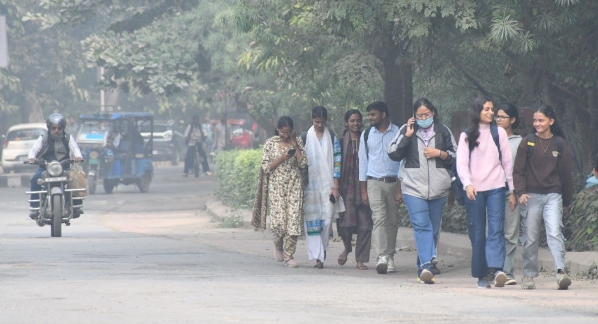
Sunlit mornings on New Year’s Day gave residents a brief respite from winter chill as clear skies raised daytime temperatures by about two degrees Celsius in parts of the state. The warm phase, driven by a passing western disturbance’s warm front, increased maximum temperatures in Babatpur and Banaras Hindu University (BHU) areas to just above the seasonal average.
Prof. Manoj Kumar Srivastava, a meteorologist at BHU, said the western disturbance responsible for the warm spell is moving on and will be followed by a cold front. “Once the cold front arrives, temperatures will fall again and a chilly westerly wind is likely to sweep the region,” he said.

Official readings on Thursday showed the Babatpur area recording a daytime maximum of 21.3 degrees Celsius, around 0.4 degrees above normal, while the minimum was 6.6 degrees Celsius, 2.3 degrees below normal. In the BHU area the maximum rose to 21.2 degrees Celsius, roughly 0.7 degrees above the seasonal norm, and the minimum remained close to the expected level at 8.8 degrees Celsius.
Visibility in the morning fell to as low as 800 metres in some places before improving to about two kilometres later in the day. The state’s capital and surrounding districts saw flights run as scheduled after the early fog cleared, although several trains experienced delays.
Dr Atul Kumar Singh, a senior scientist at the India Meteorological Department’s Lucknow regional office, linked the likely cooler minimum temperatures in January to ongoing La Niña conditions in the equatorial Pacific. He warned that much of the state may experience monthly average minimum temperatures lower than normal, with eastern and southern districts expecting one to three additional cold days compared with the climatic average.
December’s weather set a precedent: the state recorded 22 days of dense fog and 12 cold days, as persistent atmospheric stability and negligible activity of western disturbances prolonged foggy conditions. As a result, the state’s average maximum temperature for December was 2–4 degrees Celsius below normal, while minimum temperatures remained near normal across much of Uttar Pradesh.
Local forecasts paint a varied picture for different districts. Kanpur can expect mist and higher cloud cover with lingering fog in low-lying areas. Agra experienced light drizzle on New Year’s Day as an active western disturbance affected local conditions, increasing humidity and reducing daytime highs. Gorakhpur and surrounding districts will see dense fog on Friday morning, with only slight relief during the day and persistently cold conditions.
Meteorological offices advise residents to stay prepared for rapidly changing conditions over the coming days. Motorists should be cautious during periods of low visibility, and those in colder districts should take precautions against the expected dip in night-time temperatures as the cold front moves in from Sunday.
For now, the mild sunshine provides a brief comfort to baying winter, but authorities and residents alike are bracing for a return of colder, fog-prone weather as the month advances.
Key Takeaways:
- Uttar Pradesh weather forecast: a mild, sunny spell is expected to persist until Saturday, offering temporary relief from cold conditions.
- From Sunday a cold front and dense fog will return, driving temperatures down and bringing a chilly westerly wind.
- Meteorologists cite La Niña for lower-than-usual minimum temperatures in January and predict 1–3 extra cold days in eastern and southern districts.
- December saw 22 foggy days and 12 cold days across the state; visibility this week fell to as low as 800 metres.


