


The government has moved a step closer to fully digitising land administration after announcing that citizens in 19 states can now download digitally signed, legally valid land records from home and that banks in 406 districts can verify mortgages online. Officials say the measures will substantially speed access to credit and simplify property transactions.
Digital land records bring records, maps and verification online
The Department of Land Resources reported near-total completion of key components of land record digitisation. Computerisation of Records of Rights (RoRs) has been completed in 97.27 per cent of villages nationwide and cadastral maps have been digitised for 97.14 per cent of the country. About 84.89 per cent of villages have linked textual RoRs with spatial cadastral maps, creating an integrated digital ledger of land ownership and boundaries.
“The shift from in-line to online land administration is largely complete for the core recordkeeping elements,” the Ministry of Rural Development said. The move is intended to reduce disputes, lower transaction costs and improve the speed and transparency of land-related services.

One of the cornerstones of the reform is the Unique Land Parcel Identification Number, or ULPIN, a 14-digit alphanumeric code based on geocoordinates that officials describe as an Aadhaar for land. As of November 2025, ULPIN has been assigned to more than 36 crore land parcels across 29 states and union territories. The identifier aims to provide a standard reference for every parcel, helping resolve ambiguities caused by duplicate or inconsistent records.
Practical impacts on finance and urban planning
For lenders, digital verification tools have practical benefits. Banks in 406 districts now have the ability to verify mortgages online, which should reduce the time required for due diligence and loan approvals. The National Generic Document Registration System (NGDRS) has also been expanded, simplifying property registration and promoting better ease of doing business. NGDRS is implemented in 17 states and union territories, including Punjab, Maharashtra and Himachal Pradesh.
Integration of Sub-Registrar Offices (SROs) with revenue offices has proceeded rapidly. About 88.6 per cent of SROs are now interoperable with revenue records, enabling automatic mutation of land records immediately after registration. That automation is crucial for preventing gaps between a sale or transfer and the official record of ownership.
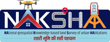
Urban land management has also seen notable progress through the NAKSHA pilot programme, which focuses on geospatial surveys of urban habitations. The pilot reported rapid progress in 157 Urban Local Bodies. Aerial surveys were completed in 116 ULBs, covering 5,915 square kilometres with high-resolution imagery. Ground truthing began in 72 ULBs and has achieved full completion in 21 cities.
Under the Scheme for Special Assistance to States for Capital Investment (SASCI) 2025–26, the Department recommended Rs 1,050 crore in funding to 24 states and union territories that met specific NAKSHA milestones. The funding aims to support urban planning, infrastructure projects and the consolidation of digital land records.
Next steps and challenges
Authorities acknowledge that while coverage of core records is high, remaining work includes improving the accuracy of linked maps and expanding NGDRS adoption to more states. Ensuring data security, interoperable systems and user-friendly portals for citizens will determine how effectively the reforms translate into faster credit access and reduced disputes.
For now, the expansion of digital land records represents a major administrative upgrade with direct benefits for homeowners, buyers and lenders across India. The combined rollout of ULPIN, NGDRS and integrated RoR-cadastral systems aims to make land transactions more efficient, transparent and reliable.
Key Takeaways:
- Citizens in 19 states can download digitally signed, legally valid land records from home, improving access to documents.
- Banks in 406 districts can verify mortgages online, accelerating credit decisions and reducing paperwork.
- RoR computerisation and cadastral mapping exceed 97% coverage; ULPIN assigned to over 36 crore parcels.
- NGDRS rollout and SRO integration streamline property registration and automatic record mutation.


