


Key Takeaways:
- São Paulo and Rio de Janeiro face red heatwave alerts and orange storm warnings, with large metropolitan areas highlighted.
- National weather service INMET warns temperatures 5°C above seasonal averages for extended periods, posing health risks.
- Authorities advise precautions against strong winds, lightning and power outages; most of the country remains under yellow alerts.

Major regions of Brazil were placed under heightened weather alerts as a severe heatwave coincides with warnings of intense storms. São Paulo and Rio de Janeiro are among the areas under the most serious advisories, with large urban and coastal zones included in the warnings issued by the National Institute of Meteorology (INMET).
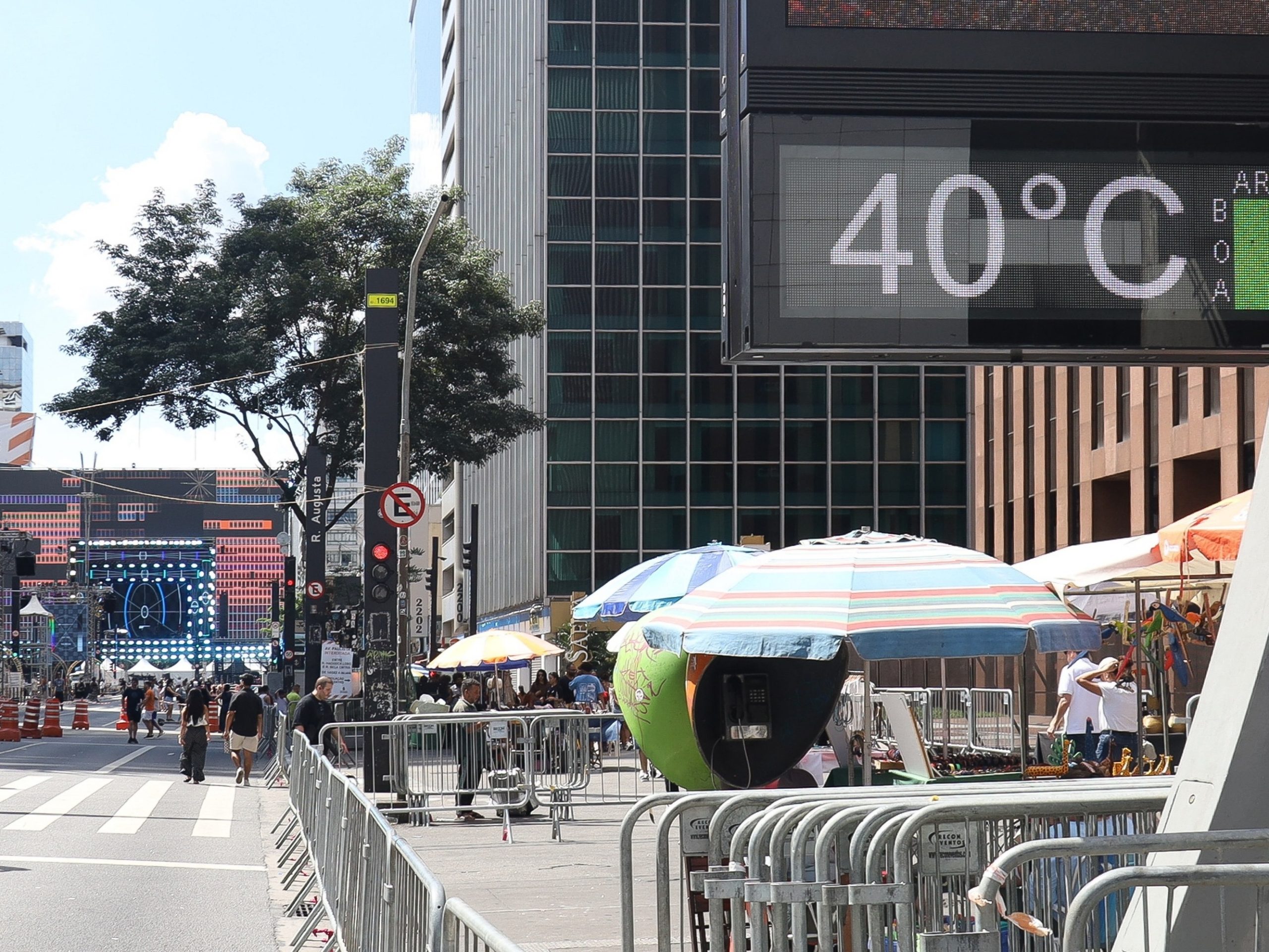
Brazil heatwave and storms alert
INMET activated a red alert for an intense heatwave affecting São Paulo from 09:00 today and lasting until the start of the evening tomorrow, the final day of the year. The institute said temperatures are expected to remain around 5°C above historical averages for the season for periods exceeding five days, a pattern that raises concerns for public health, particularly for older adults, children and those with underlying medical conditions.
At the same time, large swathes of São Paulo state — including the metropolitan region, the southern coastline, the Vale do Paraíba Paulista, São José do Rio Preto and Ribeirão Preto — were placed on orange alerts for storms. The same level of storm alert applies across much of Rio de Janeiro state, notably the metropolitan region and the Baixada Fluminense, while parts of Minas Gerais, the Federal District and areas of Goiás and Mato Grosso are also under orange warnings.
For most of the remainder of Brazil, INMET has issued yellow alerts indicating a potential for heavy rains. Yellow-alert conditions bring the possibility of winds up to 60 km/h and an elevated, though lower, chance of falling branches, flooding, lightning strikes and power cuts.
INMET has offered practical safety guidance for residents in affected areas. During episodes of strong wind and storms, people are advised not to shelter beneath trees because of the combined risk of falling branches and lightning. Parking near transmission towers and large advertising hoardings should be avoided. The institute also recommends unplugging sensitive electrical equipment and, where possible, switching off the main power supply to reduce the risk of damage from electrical surges.
Health services are on alert as heat-related illnesses can escalate rapidly when high temperatures are sustained. Officials have reminded the public to increase fluid intake, avoid prolonged exposure to the midday sun, and to check on neighbours who are elderly or live alone. Employers and event organisers have been urged to adapt outdoor activities and working conditions to reduce heat exposure.
Transport and infrastructure could also face disruption. Heavy rain and strong winds can lead to flooding of roads, reduced visibility and fallen trees that obstruct traffic. Energy utilities may experience localized outages if storm damage affects transmission lines. Residents should monitor local forecasts and heed municipal advisories for closures or evacuation orders in flood-prone zones.
With the alerts active through the end of the year, authorities have emphasised preparedness. Simple measures such as securing loose objects outdoors, avoiding non-essential travel during peak storm periods and ensuring emergency supplies are available can mitigate many immediate risks. INMET continues to update its warnings and forecasts, and the public is encouraged to follow official channels for the latest information.


