


Mumbai’s L ward, one of the earliest suburban divisions brought under the Brihanmumbai Municipal Corporation in the 1950s, has become a focal point for civic and electoral attention ahead of the BMC polls. Stretching from the edge of the island city into the eastern suburbs, the ward combines large industrial tracts, high-rise residential towers and sprawling informal settlements.
Mumbai L ward demographics and risks
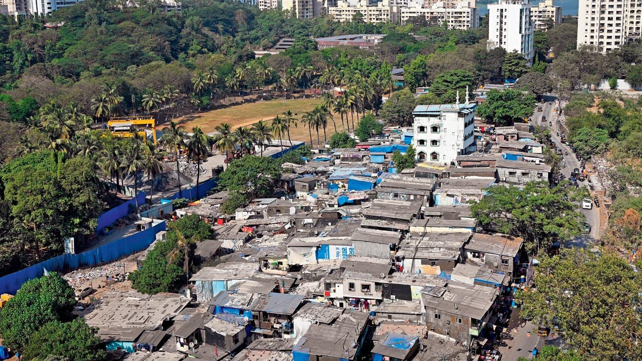
With a population of roughly 902,225, L ward is the most populous administrative ward in the city and comprises 16 electoral wards. Slum settlements account for about 70 per cent of the ward’s surface area. The Mithi river forms the western boundary and contributes to 17 chronic waterlogging hotspots during the monsoon season. Powai lake lines the northern edge and the Santacruz Chembur Link Road cuts through the ward, bringing severe traffic congestion at peak hours.
Public services and infrastructure face strain across the ward. High numbers of open stormwater drains hinder sanitation and drainage, while vulnerable settlements located near high tension lines and on hill slopes pose additional safety concerns. Open spaces are limited, and efforts to concrete local roads are only partially complete with 29 stretches finished, 29 not started and 31 partially covered.

Election landscape and local representation
L ward is divided into multiple electoral wards, each with distinct demographic and political profiles. Several of the wards recorded competitive results in the 2017 municipal elections, with councillors from parties including Shiv Sena, BJP, Congress, MNS and independents. Ward reservations have shifted in some areas for the forthcoming 2025 polls, with many seats designated for women or specific categories, and tentative voter counts varying from about 38,600 to nearly 63,000 across electoral wards.
These electoral dynamics matter because service delivery, industrial regulation and infrastructure investment are decided at the municipal level. Councillors will be under pressure to address chronic flooding, road congestion and sanitation, while balancing the needs of formal and informal communities.
Environmental and industrial concerns
Residents of Chandivli and neighbouring areas have flagged worsened air quality in recent years, attributing pollution to industrial units that local authorities and the Maharashtra Pollution Control Board have identified as unauthorised. The BMC reports ongoing action against certain units, but enforcement and remediation remain politically sensitive and operationally complex.
Flood risk is a persistent problem. The Mithi river’s catchments run through populated neighbourhoods and can overwhelm drainage during heavy monsoon rainfall. That risk intersects with housing vulnerability in slum areas, where displacement and property damage are recurring outcomes of severe weather.
What to watch in the run up to the BMC polls
Key issues for candidates and voters in the Mumbai L ward will include flood mitigation and improved drainage, industrial pollution control and enforcement, road and traffic management, and targeted upgrades in slum infrastructure. With its large electorate and diverse population, L ward will be a test of municipal governance capacity and political responsiveness in one of India’s most complex urban environments.
As campaigning intensifies, residents and civic groups will be watching how parties and individual candidates prioritise immediate relief measures and long-term resilience planning for the ward.
Key Takeaways:
- Mumbai L ward in India is the city’s largest administrative ward, with over 900,000 residents and 16 electoral wards.
- The area faces chronic flood risk from the Mithi river and rising complaints about industrial pollution in Chandivli.
- Slums cover roughly 70% of the ward, creating major infrastructure and service delivery challenges ahead of BMC elections.


